|
[#1]
Quoted:
I'm supposed to fly out of Gainesville on Monday morning at 5am for a much needed vacation. A major hurricane will most likely knock out power to my house for several days based on recent history. Plus, I did not buy trip insurance. I stand to lose approx. $14,000 plus profit from my business that will likely be closed for several days as well. FML. |
|
|
|
[#2]
Quoted:
predictive models do show it gets to cat 4 off the coast around central/ne florida 
unofficial stuff - after that, modeling seems to want it to stay right along the coast of ne florida, move along the coast of georgia, and do a carolina hit now - as a cat 3 https://www.AR15.Com/media/mediaFiles/2917/DORIAN05L_2019082806_fsct_jpg-1070194.JPG |
|
|
|
[#3]
Quoted:
Leave earlier? Empty fridge and scoot. Quoted:
Quoted:
I'm supposed to fly out of Gainesville on Monday morning at 5am for a much needed vacation. A major hurricane will most likely knock out power to my house for several days based on recent history. Plus, I did not buy trip insurance. I stand to lose approx. $14,000 plus profit from my business that will likely be closed for several days as well. FML. |
|
|
|
[#4]
Nice graphic, click the date. |
|
|
|
[#5]
Man this storm sure is getting buff. All that warm water is gonna feed that beast. Now becoming a cat 3 or 4 eventually is not good
|
|
|
|
[#6]
Quoted:
Where can I find the historical track? From origin to now? I always found it suspicious that they leave that out. 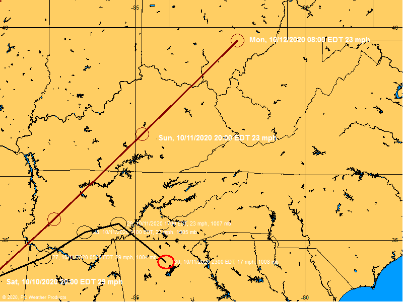
|
|
|
|
[#7]
interesting
noaa appears to have updated the 5 day forcast to have a major hurricane off the coast of florida, from a hurricane. compare image with the one from chokey above. that suggest they may be thinking further intensification than they were thinking before |
|
|
|
[#8]
Quoted:
This just keeps getting better and better  Nature is scary, and unpredictable. |
|
|
|
[#9]
Quoted:
I'm supposed to fly out of Gainesville on Monday morning at 5am for a much needed vacation. A major hurricane will most likely knock out power to my house for several days based on recent history. Plus, I did not buy trip insurance. I stand to lose approx. $14,000 plus profit from my business that will likely be closed for several days as well. FML. If you want to drop your keys off, I'll cover for you while you're gone. It's been decades since I've had a righteous college house party. I'll need you to sign a waiver for any damages. On that same note, we were on vacation in NC when Irma was inbound and had to cut it short to head back to deal with securing the farm. If you remember the excavation cluster fuck and fuel shortage, image driving headlong into that. A jerry can full of fuel behind each seat, a mapped route thru every podunk town & back road as far from the interstates as possible, topping up the tank at every opportunity. It took something close to 16 hours to get home. Thankfully we had a truck fridge packed because there was no place open to eat, the route was surreal, ghost towns, no traffic. I hate these late season hurricanes, they are always the worst. |
|
|
|
[#10]
Quoted:
That's not possible. Can't explain why but, it just isn't. right now, it looks like a hook might occur, in the models and how the systems are setting up, but it will need a few days to firm up that probability. make plans for a possible hit, though, at this time, though. |
|
|
|
[#11]
Avila ever check in from the Virgin Islands?
|
|
|
|
[#12]
From the NHC 11AM update:
000 WTNT45 KNHC 281510 CCA TCDAT5 Tropical Storm Dorian Discussion Number 17...CORRECTED NWS National Hurricane Center Miami FL AL052019 1100 AM AST Wed Aug 28 2019 Corrected day 5 intensity forecast in table. Satellite and radar images indicate that the cloud pattern has become better organized during the past several hours. This was confirmed by data from an Air Force reconnaissance plane currently investigating Dorian, which reported a flight-level wind of 72 kt and a peak SFMR value of 60 kt. The estimated central pressure was 999 mb in the last fix. On this basis the initial intensity has been adjusted upward to 60 kt. Only a slow strengthening is anticipated today while Dorian is moving through the U.S. and British Virgin Islands. However, once the cyclone reaches the western Atlantic well east of the Bahamas, it will encounter a favorable environment of low shear and warm waters, resulting in a more marked intensification. The NHC foreast is more aggressive than the previous one, and brings Dorian to category 3 intensity by the end of the period. This forecast very closely follows the intensity consensus, the HCCA model, and the SHIPS guidance. Fixes from the reconnaissance plane indicate that Dorian has been moving toward the northwest or 315 degrees at 11 kt. The cyclone is heading toward a weakness in the Atlantic subtropical ridge, and this motion should continue for the next 2 to 3 days. However, after that time, all global models build a robust ridge over the western Atlantic, and this flow pattern should force Dorian to turn more to the west-northwest toward Florida and the southeast coast of the United States. All indications are that by this Labor Day weekend, a powerful hurricane will be near the Florida or southeastern coast of the United States. The new NHC track forecast is not significantly different from the previous one, and it very closely follows the multi-model consensus TVCA and the HCCA. Users are reminded not to focus on the exact forecast track, as the average 5-day track error is around 200 miles. Key Messages: 1. Hurricane conditions are expected in the U.S. and British Virgin Islands, Culebra, and Vieques today. Tropical storm conditions are expected in Puerto Rico today with hurricane conditions possible. 2. Heavy rainfall over portions of Puerto Rico and the U.S. and British Virgin Islands could produce flash flooding during the next couple of days. Heavy rains are expected to occur over portions of the Bahamas, Florida, and elsewhere in the southeastern Untied States later this week and into early next week. 3. The risk of dangerous storm surge and hurricane-force winds is increasing in the central and northwestern Bahamas and along the Florida east coast, although it is too soon to determine where these hazards will occur. Residents in these areas should ensure that they have their hurricane plan in place and not focus on the exact forecast track of Dorian's center. FORECAST POSITIONS AND MAX WINDS INIT 28/1500Z 17.5N 64.5W 60 KT 70 MPH 12H 29/0000Z 18.7N 65.7W 65 KT 75 MPH 24H 29/1200Z 20.5N 67.0W 65 KT 75 MPH 36H 30/0000Z 22.4N 68.4W 70 KT 80 MPH 48H 30/1200Z 24.2N 69.9W 75 KT 85 MPH 72H 31/1200Z 26.5N 74.0W 90 KT 105 MPH 96H 01/1200Z 27.7N 77.7W 100 KT 115 MPH 120H 02/1200Z 28.6N 80.3W 100 KT 115 MPH $$ Forecaster Avila |
|
|
|
[#13]
Got out this AM to fill some diesel cans and a couple of propane tanks. Luckily, there isn't much more that I need to do. However, I'll probably head out tomorrow in the AM again and pick up a few nice to haves.
|
|
|
|
[#14]
What time is the next forecast?
|
|
|
|
[#15]
Quoted:
I'm supposed to fly out of Gainesville on Monday morning at 5am for a much needed vacation. A major hurricane will most likely knock out power to my house for several days based on recent history. Plus, I did not buy trip insurance. I stand to lose approx. $14,000 plus profit from my business that will likely be closed for several days as well. FML. |
|
|
|
[#16]
2PM Intermediate Advisory and 5PM for full update
|
|
|
|
[#17]
Quoted:
What time is the next forecast? They update every 6 hours, and I think every 3 when it gets closer to landfall. |
|
|
|
[#18]
Quoted:
Once these things hit the Gulf Stream, they tend to nurse there and ride the current. This whole left-turn into Central Fl is still something I'm not buying into. |
|
|
|
[#19]
Quoted:
2PM Intermediate Advisory and 5PM for full update |
|
|
|
[#20]
Quoted:
I'm supposed to fly out of Gainesville on Monday morning at 5am for a much needed vacation. A major hurricane will most likely knock out power to my house for several days based on recent history. Plus, I did not buy trip insurance. I stand to lose approx. $14,000 plus profit from my business that will likely be closed for several days as well. FML. |
|
|
|
[#21]
Quoted:
What time is the next forecast? |
|
|
|
[#22]
Quoted:
Got out this AM to fill some diesel cans and a couple of propane tanks. Luckily, there isn't much more that I need to do. However, I'll probably head out tomorrow in the AM again and pick up a few nice to haves. |
|
|
|
[#23]
Heading to Hilton Head for the long weekend (through Monday). Am I going to get wet?
|
|
|
|
[#24]
Good that my family is going to be out of town this weekend.
|
|
|
|
[#25]
Quoted:
Your business insurance should cover the loss of income. You'll have to file financial statements for the time period from the previous year. If you want to drop your keys off, I'll cover for you while you're gone. It's been decades since I've had a righteous college house party. I'll need you to sign a waiver for any damages. On that same note, we were on vacation in NC when Irma was inbound and had to cut it short to head back to deal with securing the farm. If you remember the excavation cluster fuck and fuel shortage, image driving headlong into that. A jerry can full of fuel behind each seat, a mapped route thru every podunk town & back road as far from the interstates as possible, topping up the tank at every opportunity. It took something close to 16 hours to get home. Thankfully we had a truck fridge packed because there was no place open to eat, the route was surreal, ghost towns, no traffic. I hate these late season hurricanes, they are always the worst. Quoted:
Quoted:
I'm supposed to fly out of Gainesville on Monday morning at 5am for a much needed vacation. A major hurricane will most likely knock out power to my house for several days based on recent history. Plus, I did not buy trip insurance. I stand to lose approx. $14,000 plus profit from my business that will likely be closed for several days as well. FML. If you want to drop your keys off, I'll cover for you while you're gone. It's been decades since I've had a righteous college house party. I'll need you to sign a waiver for any damages. On that same note, we were on vacation in NC when Irma was inbound and had to cut it short to head back to deal with securing the farm. If you remember the excavation cluster fuck and fuel shortage, image driving headlong into that. A jerry can full of fuel behind each seat, a mapped route thru every podunk town & back road as far from the interstates as possible, topping up the tank at every opportunity. It took something close to 16 hours to get home. Thankfully we had a truck fridge packed because there was no place open to eat, the route was surreal, ghost towns, no traffic. I hate these late season hurricanes, they are always the worst. |
|
|
|
[#26]
I have a friend leaving Sunday for a cave diving class in northern FL. She thinks it will have “spun out” by the time she arrives and is not giving any consideration to damage, flooding, etc., the area might experience.

|
|
|
|
[#27]
My dad is heading to Sanibel Island and will get there Saturday. Hopefully the 3' elevation will keep his ankles out of the water.
|
|
|
|
[#28]
Quoted:
Yup, gonna be a suck day here for sure. I'm scheduled to fly from GNV at 2pm Monday. I'm fairly certain if the winds are what they predict that GNV will close to traffic. Quoted: I'm in Gainesville, PM me if I can help |
|
|
|
[#29]
Quoted:
Once these things hit the Gulf Stream, they tend to nurse there and ride the current. This whole left-turn into Central Fl is still something I'm not buying into. Quoted:
Quoted:
predictive models do show it gets to cat 4 off the coast around central/ne florida
unofficial stuff - after that, modeling seems to want it to stay right along the coast of ne florida, move along the coast of georgia, and do a carolina hit now - as a cat 3 https://www.AR15.Com/media/mediaFiles/2917/DORIAN05L_2019082806_fsct_jpg-1070194.JPG |
|
|
|
[#30]
I hope the Cape doesn’t get smacked too hard.
I bet this thing keeps moving north. Jacksonville/ Georgia beware. |
|
|
|
[#31]
Well my post from this morning was wrong. I thought it had another day or two of mediocrity before it got its act together. I figured it would go over PR and weaken quite a bit and take a day or more to re-assemble itself.
Well it's missing PR to the east. The dry air that has been hindering it since its formation is almost gone. Shear is predicted to stay low. The sea surface temperatures are around 85 degrees. The depth of warm water is plenty to create a monster hurricane. It has plenty of time over these favorable conditions to become a real nightmare. As I said before, I don't claim to be an expert but I've been watching these for many years now as I have a fascination with extreme weather. I really don't see anything in the next few days stopping this from being a major hurricane making landfall on the east coast. I am not nearly qualified to make a guess as to where it will strike. At this time it's anywhere from Miami to NC. Even that wide of a range could change. As in it could make it into the gulf for a second landfall.
Stay safe and stay informed. |
|
|
|
[#32]
As of 2pm EDT it is a hurricane.
|
|
|
|
[#33]
Quoted:
As of 2pm EDT it is a hurricane. 
|
|
|
|
[#34]
Quoted:
I have a friend leaving Sunday for a cave diving class in northern FL. She thinks it will have “spun out” by the time she arrives and is not giving any consideration to damage, flooding, etc., the area might experience. |
|
|
|
[#35]
Places are already out of water in my area. Central Florida. People are preparing sooner and sooner... I remember when we had those three hurricanes in one year people were stocking up hours before one arrived.

It's nice people are prepping sooner but it also makes it harder to find things last minute. |
|
|
|
[#36]
Quoted:
Well now it's a hurricane party. Quoted:
Quoted:
As of 2pm EDT it is a hurricane. 
|
|
|
|
[#37]
Quoted:
I hope the Cape doesn’t get smacked too hard. I bet this thing keeps moving north. Jacksonville/ Georgia beware. |
|
|
|
[#38]
Quoted:
I have a friend leaving Sunday for a cave diving class in northern FL. She thinks it will have “spun out” by the time she arrives and is not giving any consideration to damage, flooding, etc., the area might experience. |
|
|
|
[#39]
Quoted:
Places are already out of water in my area. Central Florida. People are preparing sooner and sooner... I remember when we had those three hurricanes in one year people were stocking up hours before one arrived.
It's nice people are prepping sooner but it also makes it harder to find things last minute. |
|
|
|
[#40]
Currently, it has been upgraded to Cat 1, expected to intensify to Cat 3 and to come ashore near Titusville Sunday morning.
|
|
|
|
[#41]
Been busy working on something in the garage.
Is something going on I should know about? |
|
|
|
[#42]
Quoted:
Well now it's a hurricane party. |
|
|
|
[#43]
Quoted:
Been busy working on something in the garage. Is something going on I should know about? |
|
|
|
[#44]
Quoted:
Thread title update time OP Quoted:
Quoted:
Quoted:
As of 2pm EDT it is a hurricane. |
|
|
|
[#45]
2:00 PM AST Wed Aug 28
Location: 18.3°N 65.0°W Moving: NW at 13 mph Min pressure: 997 mb Max sustained: 75 mph 
|
|
|
|
[#46]
Quoted:
Taking gym007 with you? Quoted:
Quoted:
Guess I need to go fill my gas cans up at lunchtime. Come 5pm places will be swamped. |
|
|
|
[#47]
If you have a shortwave radio with single side band you can listen to the HAM radio operator reports:
Hurricane HAM radio frequencies: 14.325.00 MHz (day) and 7.268.00 MHz (evening) - the net went active today at 10AM EST. More here: 2017 Hurricane Frequencies |
|
|
|
[#48]
One of the bad scenarios has it moving along the coast of Florida and up the Georgia/South Carolina coast. That could put hurricane force winds along a long stretch of land.
A good rule is always anticipate it can be (assume it will be) one cat higher by impact. Everybody be safe on the south east coast. |
|
|
|
[#49]
In on this shit show. Water already gone at BJs, more delivery expected after 4pm.
|
|
|
|
[#50]
Quoted:
One of the bad scenarios has it moving along the coast of Florida and up the Georgia/South Carolina coast. That could put hurricane force winds along a long stretch of land. |
|
|
 Win a FREE Membership!
Sign up for the ARFCOM weekly newsletter and be entered to win a free ARFCOM membership. One new winner* is announced every week!
You will receive an email every Friday morning featuring the latest chatter from the hottest topics, breaking news surrounding legislation, as well as exclusive deals only available to ARFCOM email subscribers.

AR15.COM is the world's largest firearm community and is a gathering place for firearm enthusiasts of all types.
From hunters and military members, to competition shooters and general firearm enthusiasts, we welcome anyone who values and respects the way of the firearm.

Subscribe to our monthly Newsletter to receive firearm news, product discounts from your favorite Industry Partners, and more.
Copyright © 1996-2024 AR15.COM LLC. All Rights Reserved.
Any use of this content without express written consent is prohibited.
AR15.Com reserves the right to overwrite or replace any affiliate, commercial, or monetizable links, posted by users, with our own.


