|
Posted: 2/1/2022 10:34:49 PM EDT
This satellite image provided by the National Oceanic and Atmospheric Administration shows a thunderstorm complex which was found to contain the longest single flash that covered a horizontal distance on record, at around 768 kilometers (477 miles) across parts of the southern United States on April 29, 2020. Two stormy parts of the Americas set records for longest lightning flashes back in 2020, the World Meteorological Organization said Monday, Jan. 31, 2022.
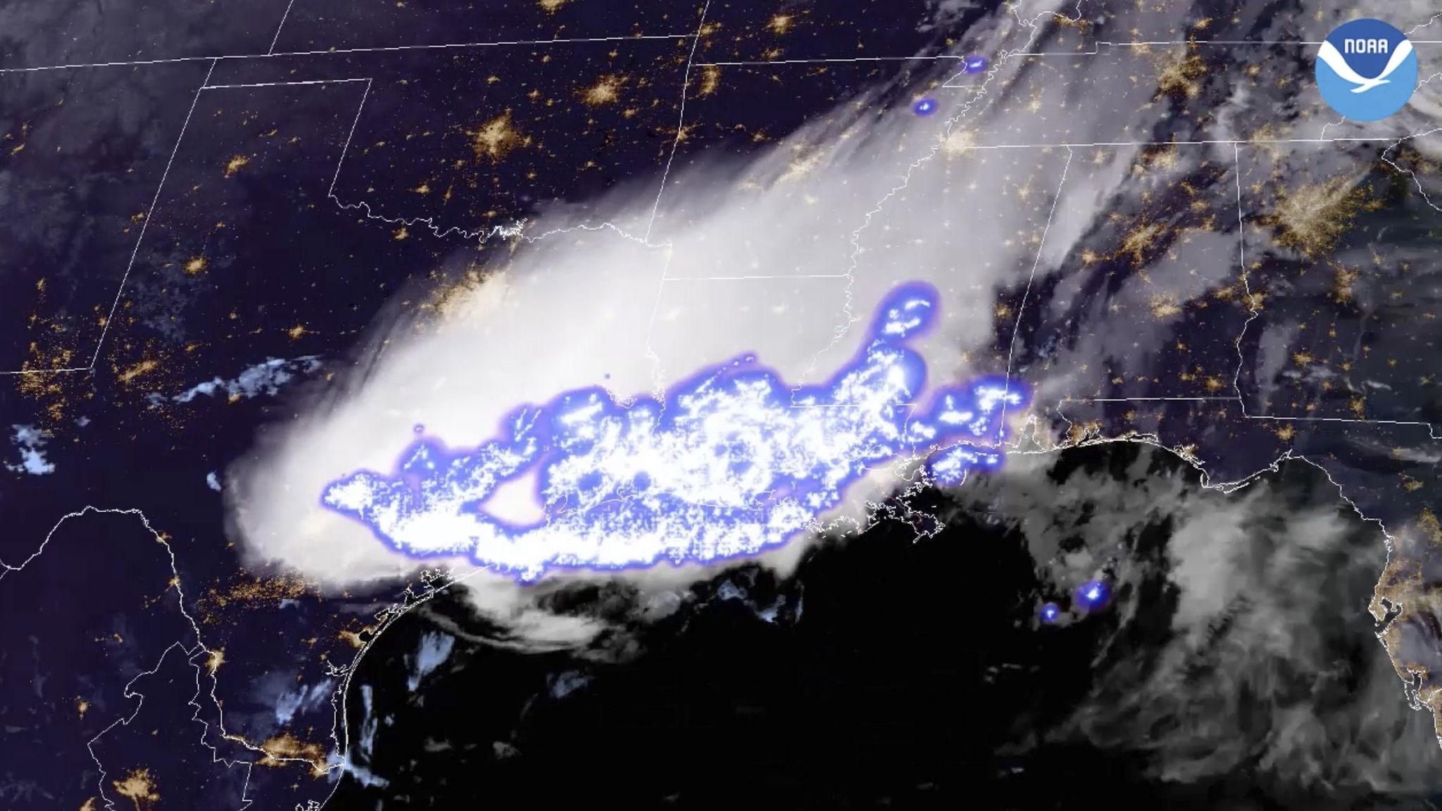 The World Meteorological Organization announced on Monday that it had confirmed two lightning “megaflash” records. The findings, which come after careful data-checking and rigorous certification processes, include one record event that occurred over the Lower 48 states. On April 29, 2020, a sprawling mass of strong to severe thunderstorms produced a 477.2-mile-long lightning strike over the southern United States. It stretched from near Houston to southeast Mississippi. The record beats a 440-mile-long megaflash that occurred over southern Brazil on Halloween of 2018. The WMO also identified a world record for the long-lasting lightning flash. It lit up the skies over Uruguay and northern Argentina for 17.1 seconds on June 18, 2020, surpassing a 16.73-second flash recorded over northern Argentina on March 4, 2019. “These are extraordinary records from single lightning flash events,” wrote Randall Cerveny, rapporteur of Weather and Climate Extremes for WMO, in a statement. Megaflashes dwarf ordinary lightning strikes. We’re accustomed to seeing what’s going on near the ground, including conventional cloud to ground lightning bolts. Hundreds or thousands such strikes might accompany a run-of-the-mill thunderstorm on a summer’s afternoon. Megaflashes are different. They’re enormous. They snake through regions of high electric field and can travel for hundreds of miles while lasting more than 10 seconds. Since most storm clouds are fewer than 10 miles high, lightning can’t grow terribly long in the vertical direction. But megaflashes have plenty of space to sprawl in the horizontal. All megaflashes accompany MCSs, or mesoscale convective systems. MCSs are clusters of thunderstorms that often rage overnight and can occupy an area the size of several states, last for hours and stretch 750 miles or more end-to-end. They’re a staple of the spring and early summer across the southern and central United States, and are also common in Brazil, Argentina and Uruguay. South America’s “Altiplano,” or high Andean Plateau, also brews prolific lightning-producing storms. Megaflashes crawl through the clouds, but can produce or induce ground connections at various points. Sometimes MCSs merge, leading to amplified and more chaotic electric fields that can also be supportive of megaflashes. Covering so much real estate means megaflashes flicker for an extended duration. While atmospheric electrodynamicists had long since theorized about the existence of megaflashes, the scale and duration of said flashes was not well-understood until recently. Conventional lightning detection arrays, which rely on a network of ground-based sensors that detect a strike’s electromagnetic field and use multistation triangulation to determine its location, are most effective in plotting cloud to ground discharges. “Detecting these extreme lightning events is very difficult due to their exceptional rarity and scale,” wrote Michael Peterson of the Space and Remote Sensing Group at Los Alamos National Laboratory, in an email. “Your sensor has to be in just the right place at perfectly the right time to be able to see it — and the instrument has to be capable of measuring something as large as a megaflash. Most sensors historically have fallen short of these requirements.” More  Lightning bolt stretching 477 miles over 3 U.S. states sets world record 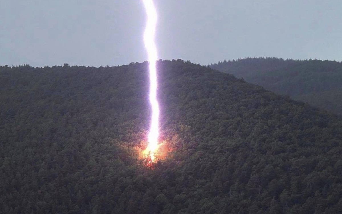  CRAZIEST LIGHTNING STRIKES |
|
|
|
[#1]
We're all gonna die, this must be brand new and caused by global warming
/s |
|
|
|
[#2]
I didn't see shit.
|
|
|
|
[#3]
Bullshit.
What really happened.  Real Genius (8/8) Movie CLIP - Jerry's House of Popcorn (1985) HD |
|
|
|
[#4]
Isn't that how the aliens arrived in War of the Worlds
|
|
|
|
[#5]
Explains Sodom and Gomorrah.
|
|
|
|
[#6]
Why did this come to mind lol…
 The Great Outdoors - Lightning Rod Reg |
|
|
|
[#7]
I almost got hit by lighting camping on a ridge in Boy Scouts during a storm.
 Every thing turned black and white like a photo negative. Every thing turned black and white like a photo negative.
|
|
|
|
[#8]
300,000,000 - 300,000,001. Whatever it takes.
|
|
|
|
[#9]
I wish I Could post vids from my phone. I have lots of stuff including the time the truck I was in was almost hit out in Indy and the stuff that lit this crappy state on fire
|
|
|
|
[#10]
Hmm, wanna see it in 3d, how high did it reach.
|
|
|
|
[#11]
But can you hammer a 6" spike through a 2x4 with your penis? |
|
|
|
[#12]
meh, it was just heat lighting
|
|
|
|
[#13]
What round for megaflash?
YESSSSSS I GOT IN BEFORE YOU DID |
|
|
|
[#14]
Quoted: Isn't that how the aliens arrived in War of the Worlds Oh don't be such a chicken. This is the herald of things far more powerful and far more realistic than those Martian morons that were quite literally, too stupid to live.  Paul's first encounter with the spice melange |
|
|
|
[#15]
Who found all of the dragon balls?
|
|
|
|
[#16]

|
|
|
|
[#17]
|
|
|
|
[#18]
Elmer Fudd was after Bugs with his magic helmet.
5kH0Bag0akc |
|
|
|
[#19]
damn!!! that car in that video got smoked!!!
|
|
|
|
[#20]
I bet I could get 1.21 gigawatts from that baby.
|
|
|
|
[#21]
I’m not certain of the date but it coincides with the approximate timeframe I jumpseated from Memphis to Huston ( right before the pandemic really started to heat up) If it’s the storm I remember it was awe inspiring.
The most vivid and spectacular display of St. Elmo’s fire I’ve ever seen in the flight deck. Like this video but it was nonstop. Like being immersed in a perpetual lighting bath.  St. Elmo's fire in airplane cockpit - Elmsfeuer im Airbus Cockpit ETA: yeah, I’m pretty sure I was in the air during this event |
|
|
|
[#22]
Had lighting strike a power pole on our easement back in 2003. Blew the transformer with massive fireball and boom sound, the lines dropped. DTW had it repaired in a day.
It was pretty loud. |
|
|
|
[#23]
Quoted: What round for megaflash? YESSSSSS I GOT IN BEFORE YOU DID Any will due as long as it uses Remington Etronx primers |
|
|
|
[#24]
Well. That's it then. They're here.
|
|
|
|
[#25]
I took these pics at work. One at the dock, the other in Georgia.
  |
|
|
|
[#26]
MegaFlash would be a good band name.
|
|
|
|
[#27]
That's some scary stuff.
|
|
|
|
[#28]
Ok, ok, we get it. Lighting farts after eating chili with beans is MUCH WORSE!
|
|
|
|
[#29]
I, for one, will be welcoming Thor upon his imminent arrival.
|
|
|
 Win a FREE Membership!
Sign up for the ARFCOM weekly newsletter and be entered to win a free ARFCOM membership. One new winner* is announced every week!
You will receive an email every Friday morning featuring the latest chatter from the hottest topics, breaking news surrounding legislation, as well as exclusive deals only available to ARFCOM email subscribers.

AR15.COM is the world's largest firearm community and is a gathering place for firearm enthusiasts of all types.
From hunters and military members, to competition shooters and general firearm enthusiasts, we welcome anyone who values and respects the way of the firearm.

Subscribe to our monthly Newsletter to receive firearm news, product discounts from your favorite Industry Partners, and more.
Copyright © 1996-2024 AR15.COM LLC. All Rights Reserved.
Any use of this content without express written consent is prohibited.
AR15.Com reserves the right to overwrite or replace any affiliate, commercial, or monetizable links, posted by users, with our own.


